One factor driving the expansion of the mobile mapping industry is the incorporation of satellite mapping capabilities into more and more smartphones and other IoT-connected devices. Environmental monitoring, 3D mapping, accident investigation, disaster response, and machinery control are some of the applications of the Global Navigation Satellite System (GNSS) that have contributed to the boost in demand for this industry. New automated and quick data collection methodologies are also being encouraged by this sector, with the help of the latest 5G internet technology. Transportation, building, and urban planner decision-makers can benefit greatly from the insights provided by these systems, which aid in planning, design, and resource allocation.
Market growth in mobile mapping is opening up new possibilities for transportation, utility management, and city planning databases, as well as for the creation and maintenance of existing databases. Mobile mapping technology utilizing 360° long-lasting real sense cameras (LiDAR) for aerial photogrammetry or terrestrial surveying is being used by a number of companies, including Google, Microsoft, Apple, and others. In the United States, for example, tech giants like Google have used a fleet of 1,000+ cars to supply map data for the internet. Revenue growth in the mobile mapping market is being propelled by technical improvements that generate patterns in spatial landscape data and incorporate them into real-time 3D visualization models.
Mobile mapping Environmental monitoring using Geographic Information System (GIS) is on the rise. Researchers in the environmental field are making use of geographic information system (GIS) tools for mobile mapping to make environmental monitoring activities, such hurricane and storm forecasting, easier. Additional factors fueling the expansion of the mobile mapping industry are research initiatives supported by the National Aeronautics and Space Administration (NASA) that aim to improve environmental monitoring and natural resource management.
A digital strategy is essential for a successful transformation, but digitizing city infrastructures, planning, and optimizing resources are the bedrock of the Smart City. The concept of digitalizing cities and envisioning urban development that incorporates information and communication technology is growing, with numerous smart cities projects either already in motion or about to be launched. Geospatial data is essential for smart city projects and any strategy for urban development. Among its components are 3D models that incorporate elements of mixed reality and maps that accurately depict the terrain. The development, administration, and monetization of smart cities are all dependent on an accurate and trustworthy geospatial database. As an example, Amsterdam made use of the Trimble MX7 handheld GPS system. Several divisions depend on street-level photography, including public safety, public space management, and tax collection. So, Amsterdam was able to shoot street-view photos whenever they wanted and share them with anyone in the company thanks to the mobile mapping technology.
Organizations are quickly embracing digital transformation by incorporating new technology to streamline and quicken their operational procedures. Even if mobile mapping solutions might make environment scanning faster, more flexible, and more secure, they nonetheless increase CAPEX for businesses. A hefty investment in scanners, encoders, cameras, and other forms of IT software would be necessary for businesses seeking all-encompassing mobile mapping solutions. Increasing spending on device and network security would also be necessary. Organizations with limited budgets will be unable to embrace mobile mapping systems due to their high initial cost. Consequently, routine road corridor surveys have been severely constrained by the prohibitive expense of system procurement and deployment.
The mobile mapping industry was important in collecting affected individuals' whereabouts and travel records during the COVID-19 pandemic. In order to better understand the distribution of diseases in a given area and to better map demographic data, governments are increasingly turning to mobile mapping applications. Thus, the mobile mapping market has benefited from the pandemic. Furthermore, hardware manufacturers have been hit hard by the epidemic as a result of supply chain interruptions and government prohibitions.
Increases in investments in smart city initiatives and the necessity for precise land-based maps are two factors driving the global rise of mobile mapping. Furthermore, substantial initial investment impacts market growth. In addition, the development of autonomous driving systems impacts the expansion of the market. It is expected, however, that the expansion of the worldwide mobile mapping market would be affected by each of these variables over the projected period.
Smart cities rely on digital solutions for infrastructure digitization, resource planning and optimization, and overall urban change. With the proliferation of smart city projects, the use of ICT and urban digitization is changing the face of city planning. Spatial data is the backbone of smart city development plans. Using mixed-reality 3D models and maps, it provides in-depth information about the terrain. Organizations require a trustworthy and precise geographic database to build and oversee smart cities, which generate revenue for city administrators. One city that has used smart city technology is Amsterdam, which utilized the Trimble MX7 mobile mapping system.
Report Coverage
Global Mobile Mapping research report categorizes the market for global based on various segments and regions, forecasts revenue growth, and analyzes trends in each submarket. Global Mobile Mapping report analyses the key growth drivers, opportunities, and challenges influencing the global market. Recent market developments and Mobile Mapping competitive strategies such as expansion, product launch and development, partnership, merger, and acquisition have been included to draw the competitive landscape in the market. The report strategically identifies and profiles the key Mobile Mapping market players and analyses their core competencies in each global market sub-segments.
| REPORT ATTRIBUTES | DETAILS |
|---|---|
| Study Period | 2017-2031 |
| Base Year | 2023 |
| Forecast Period | 2023-2031 |
| Historical Period | 2017-2021 |
| Unit | Value (USD Billion) |
| Key Companies Profiled | MapJack, EveryScape Inc., Novatel Inc, Hexagon AB, Optech LLC, Google LLC, Qualcomm Inc., Foursquare Labs, Mitsubishi Electric Corporation, GeoSLAM, Pasco Corporation, Leica Geosystems, Trimble Inc., Javad GNSS Inc., Apple Inc., Microsoft Corporation, Black & Veatch |
| Segments Covered | • By Product |
| Customization Scope | Free report customization (equivalent to up to 3 analyst working days) with purchase. Addition or alteration to country, regional & segment scope |
Key Points Covered in the Report
- Market Revenue of Mobile Mapping Market from 2021 to 2031.
- Market Forecast for Mobile Mapping Market from 2021 to 2031.
- Regional Market Share and Revenue from 2021 to 2031.
- Country Market share within region from 2021 to 2031.
- Key Type and Application Revenue and forecast.
- Company Market Share Analysis, Mobile Mapping competitive scenario, ranking, and detailed company
profiles. - Market driver, restraints, and detailed COVID-19 impact on Mobile Mapping
Market
Competitive Environment:
The research provides an accurate study of the major organisations and companies operating in the global Mobile Mapping market, along with a comparative evaluation based on their product portfolios, corporate summaries, geographic reach, business plans, Mobile Mapping market shares in specific segments, and SWOT analyses. A detailed analysis of the firms' recent news and developments, such as product development, inventions, joint ventures, partnerships, mergers and acquisitions, strategic alliances, and other activities, is also included in the study. This makes it possible to assess the level of market competition as a whole.
List of Major Market Participants
MapJack, EveryScape Inc., Novatel Inc, Hexagon AB, Optech LLC, Google LLC, Qualcomm Inc., Foursquare Labs, Mitsubishi Electric Corporation, GeoSLAM, Pasco Corporation, Leica Geosystems, Trimble Inc., Javad GNSS Inc., Apple Inc., Microsoft Corporation, Black & Veatch
Primary Target Market
- Market Players of Mobile Mapping
- Investors
- End-users
- Government Authorities
- Consulting And Research Firm
- Venture capitalists
- Third-party knowledge providers
- Value-Added Resellers (VARs)
Market Segment:
This study forecasts global, regional, and country revenue from 2019 to 2031. INFINITIVE DATA EXPERT has segmented the global Mobile Mapping market based on the below-mentioned segments:
Global Mobile Mapping Market, By Enterprise Size
Large Enterprises
SMEs
Global Mobile Mapping market, By Application
Asset Management
Others
Topographic Mapping
Road Surveys
3D Modeling
Global Mobile Mapping Market, By Industry Vertical
Construction & Real Estate
Energy & Utilities
Transportation & Logistics
Retail
Government & Public Sector
Manufacturing
Others
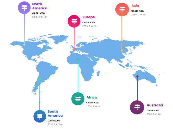
Global Mobile Mapping market, Regional Analysis
- Europe: Germany, Uk, France, Italy, Spain, Russia, Rest of Europe
- The Asia Pacific: China,Japan,India,South Korea,Australia,Rest of Asia Pacific
- South America: Brazil, Argentina, Rest of South America
- Middle East & Africa: UAE, Saudi Arabia, Qatar, South Africa, Rest of Middle East & Africa
You will get in-depth and extensive mobile mapping market market research and competitor analysis for your business to help you develop more profound insights into the mobile mapping market Market.
Through INFINITIVE Data Expert is a professional Market Research services, I will identify the mobile mapping market market size, demand & opportunities, growth rate, and target audience with a comprehensive analysis of your competitors.


